Using Satellite Imagery for Late Season Crop Management Decisions
Come along and hear a range of topics and site visits including:

Understanding crop dry down using satellite imagery.
Scouting for and visualising the extent of frost affected crops.
Harvest management (particularly in poor weather conditions).
Satellite imagery and yield predictors.
Best practice soil testing techniques, using satellite imagery and other simple map layers to strategically soil test over the summer months.
Frost Firestik fields and observational site visit with Michael Eyres.
Mixed Pasture species site visit.
WHEN: 18th October, 3.30pm.
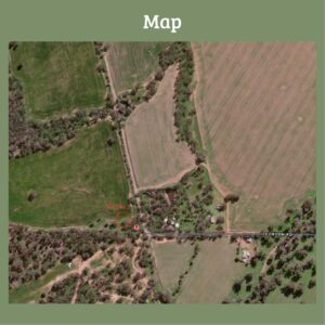
WHERE: Meet at the end of Cordon Road, Melrose. (Please see map)
Please send RSVP’s to Jessica Koch on 0407986557.
This is a combined event through funding from MLA and the SA Drought Hub